 We are living in a time when the global average temperature is rising, the sea levels and flooding risk due to climate change are increasing, and the quality and level of our water resources has become threatened. Prolonged drought is contributing to shortages on one hand, with extreme weather leading to increased rainfall, floods, mudslides and hurricanes at other times. It’s during this era that Blue Urbanism calls us all into action.
At its core, Blue Urbanism asks us "how we terrestrial urbanites" can steward and take care of these vital waterways around us - rivers that give life to fish species as well as plants; lakes that not only provide drinking water but also recreation for city-dwellers; beaches over which many children learn about nature from awe to respect; estuaries with stunning natural beauty enriched by human craftsmanship—the list goes on. Through Timothy Beatley’s book Blue Urbanism, he highlights imaginative ways each person can make a difference in order to help develop healthier coastal cities where people feel safer playing outdoors and no longer fear contamination or loss of their natural habitats - developing habitats for marine wildlife, implementing new tools or practices to clean up waste and pollution, restoring and developing waterside locations to cultivate resident and tourist connections, and more.
In this blog post, we explore why it matters that Norwalk Residents come together to understand what Blue Urbanism means and harness its capacity – so come join us!
What is Blue Urbanism and Why Does It Matter?
 We are living in a time when the global average temperature is rising, the sea levels and flooding risk due to climate change are increasing, and the quality and level of our water resources has become threatened. Prolonged drought is contributing to shortages on one hand, with extreme weather leading to increased rainfall, floods, mudslides and hurricanes at other times. It’s during this era that Blue Urbanism calls us all into action.
At its core, Blue Urbanism asks us "how we terrestrial urbanites" can steward and take care of these vital waterways around us - rivers that give life to fish species as well as plants; lakes that not only provide drinking water but also recreation for city-dwellers; beaches over which many children learn about nature from awe to respect; estuaries with stunning natural beauty enriched by human craftsmanship—the list goes on. Through Timothy Beatley’s book Blue Urbanism, he highlights imaginative ways each person can make a difference in order to help develop healthier coastal cities where people feel safer playing outdoors and no longer fear contamination or loss of their natural habitats - developing habitats for marine wildlife, implementing new tools or practices to clean up waste and pollution, restoring and developing waterside locations to cultivate resident and tourist connections, and more.
In this blog post, we explore why it matters that Norwalk Residents come together to understand what Blue Urbanism means and harness its capacity – so come join us!
Recommendations for Norwalk's Industrial Waterfront
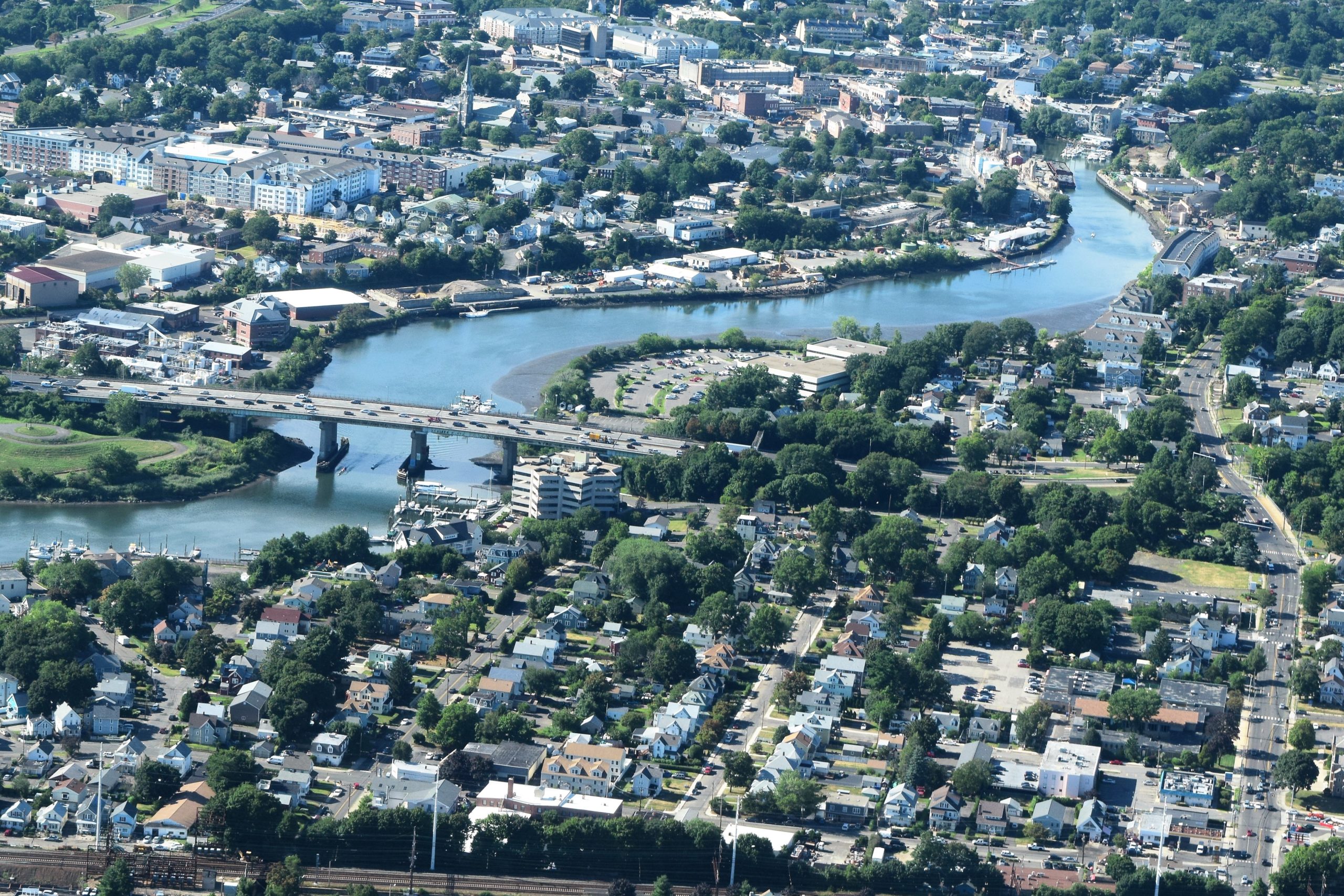 A significant portion of the waterfront in Norwalk, CT has been zoned and used for industrial use. The city undertook a planning exercise to determine the appropriate land uses for these historically industrial waterfronts. The draft plan, Industrial Waterfront Land Use Plan, has been developed for the city to use as a policy roadmap, allowing these areas to grow and change in a way that balances and aligns with both public and private needs.
Why the Norwalk, CT Waterfront Rezoning Matters
Before we begin, let’s take a quick look at why the Norwalk waterfront needed to be reevaluated.
It’s quite an understatement to say that industrial waterfront land has vastly changed in the last century. In Norwalk, the use of industrial waterfront has been transitioning from strictly industrial uses to less intense uses, such as marinas and small boat facilities, while legacy uses such as oyster harvesting and bulkhead repairs continue to be integral parts of the community. In addition, modern innovations, like the innovative boat building and storage or marine highway programs like harbor harvest hold promise for future economic success for our harbor.
However, updating industrial waterfronts comes with its challenges. The historical use of Norwalk's urban waterfront plays such an enormous part in the city's identity. It's also an essential piece of the local economy. The Norwalk waterfront has an array of uses.Some areas are zoned exclusively for heavy industrial uses, while others are reserved for commercial or public use and some have a mix of uses which can include residential This is why the Norwalk Industrial Waterfront Land Use planning process looked at ways to benefit both public and private institutions alike, including the input of many stakeholders to thoughtfully address these uses. Read further to learn about the major themes that occurred throughout the planning process.1. Increased Public Access
One common desire mentioned in the numerous meetings with the public is for Norwalk residents and tourists to have more access to the waterfront. An asphalt factory near the head of the Norwalk river is a good example. Not only is The facility under-utilized, but locating an asphalt plant in proximity to your downtown is not a desired land-use scenario. In addition, the public feels the land could better serve the community by broadening its usage. This automatically indicates the need for changing the zoning laws, which is already underway. This site would need to be rezoned from its current industrial status. It's just one example of how shifting the zoning laws may impact the broader waterfront ecology.2. Reduced Heavy Industry
Rezoning to determine the appropriate types of heavy industrial usage and where they should be located have been common themes across every public meeting. The current zoning laws prioritize heavy industry. The updated zoning regulations would increase light industrial and artisanal industries. These would be able to exist alongside residential zones to buffer more heavy industrial uses. This would allow for more mixed-use areas near the waterfront.3. Mixed Use
Whatever form the final rezoning takes, mixed-use could play an important part. We see this in the proposal of placing light industry next to residential, for instance. This would open the way for mixed-use marine commercial zoning, allowing more marine commercial businesses to remain on the waterfront while opening up the area around them for mixed uses. Examples of marine commercial businesses could include yacht clubs or marinas while mixed uses could be a marine retail store with residential above.4. Reimagining Water Street
How Water Street looks, feels and functions has been debated many times over the years. The Plan’s vision for the area strives to strike a balance between the desire for public access and views of the water, with the need to support Norwalk’s thriving marine industries, while also improving the built environment of the street to compliment the desired development occurring elsewhere in the neighborhood. Increasing the amount of greenery, particularly waterfront buffers, is another common concern, which would also help to address environmental issues. This is another major goal for many of the proposed changes to the industrial waterfront. These suggestions will all help to keep the area vital, making it more appealing to residents and visitors.5. Retain Protect, and Reinvest in Water-Dependent Businesses
There was consensus among stakeholders of the need to support and maybe even expand businesses that are water dependent in Norwalk, especially in the Water Street Marina area in South Norwalk. The concern is that they continue to contribute to Norwalk and the regional economy. Ways to do this include: increasing the protected marine commercial zone and investing in infrastructure for these industries– such as bulkheads, dock repairs, and dredging of the Norwalk River. While this is an acknowledged goal of the plan, it must be done in a way that considers the other identified needs and goals of the study, so the waterfront is resilient, active and accessible to all.6. Preserve the Environment and Prepare for Resiliency
For waterfront areas, consideration of environmental factors is especially important. Recommendations for all the waterfront parcels is to increase flood resilience, improve water quality, and promote ecological restoration. Investing in things like impermeable to permeable pavement or vegetation/soft shoreline would help reduce flooding in the more urban areas of the waterfront. These would limit property damage and ensure businesses are able to resume operations soon after a major storm. Expansion of tidal marshes, living shoreline, vegetative buffers, or other passive flood protection would help to mitigate flooding, improve water quality, and restore habitat in less inhabited areas. The final recommendations in the plan, like those above, will inform the city as they work to update policy and develop the waterfront along Norwalk Harbor and the Norwalk River, including the Harbor Management Plan as well as land use regulations. Stay up-to-date on the Norwalk, CT waterfront and other planning efforts of the City and give us your input.Read the Full Plan For Recommendations for Different Areas
Norwalk Residents Weigh In On Industrial Waterfront Uses
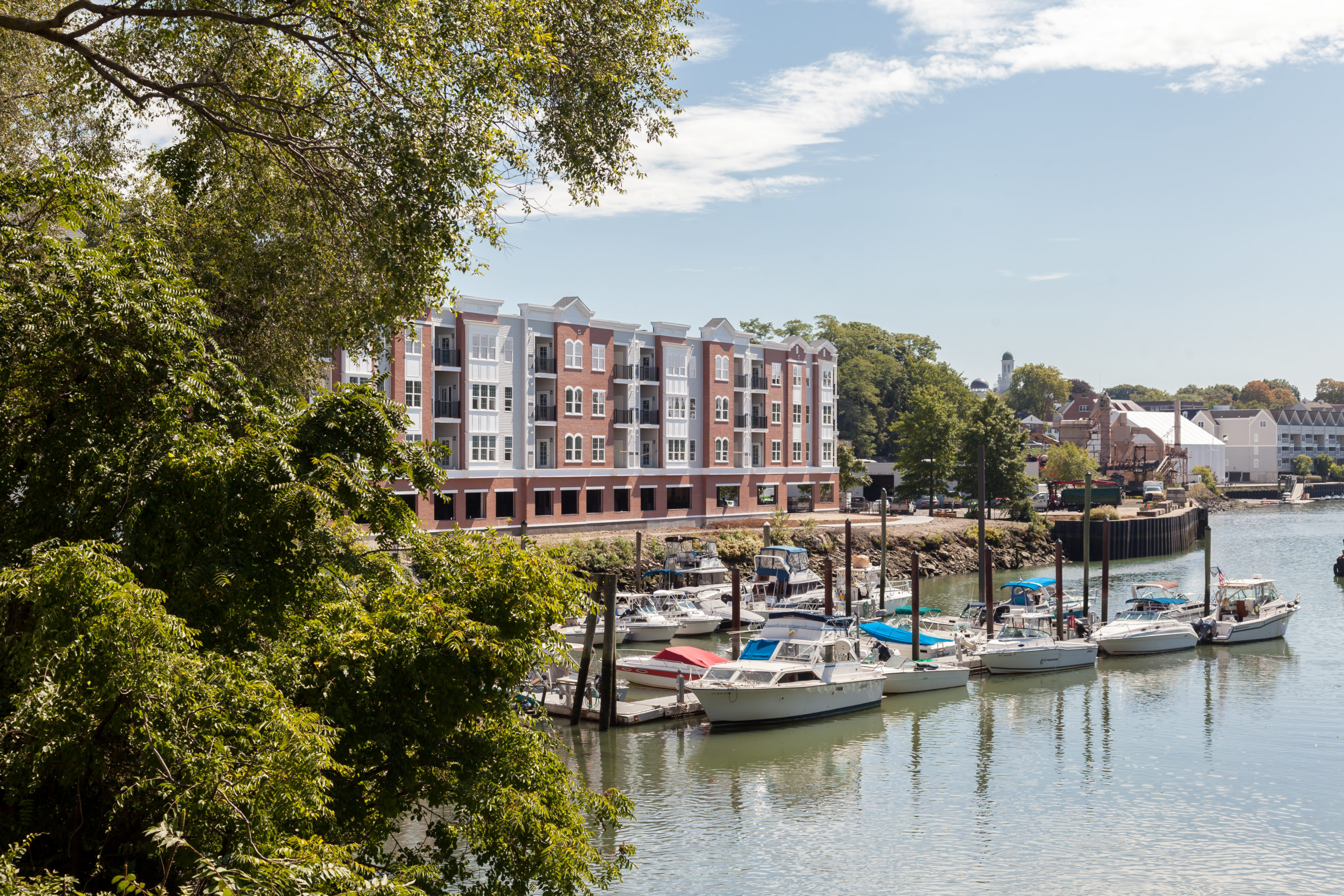 As the City of Norwalk studies how to optimize the industrial areas of its waterfront resources along the mid-to-upper Norwalk Harbor, the Planning and Zoning office is reaching out to the public and other stakeholders for their thoughts.
Interactive Waterfront Survey Findings
In all, more than 150 comments were made by more than 55 stakeholders, with 1,100 people visiting the site. A large majority of comments involved a desire to include public access and open space along Norwalk’s waterfront. Another popular comment was regarding infrastructure along waterfront areas such as the inclusion of sidewalks, paths and trails.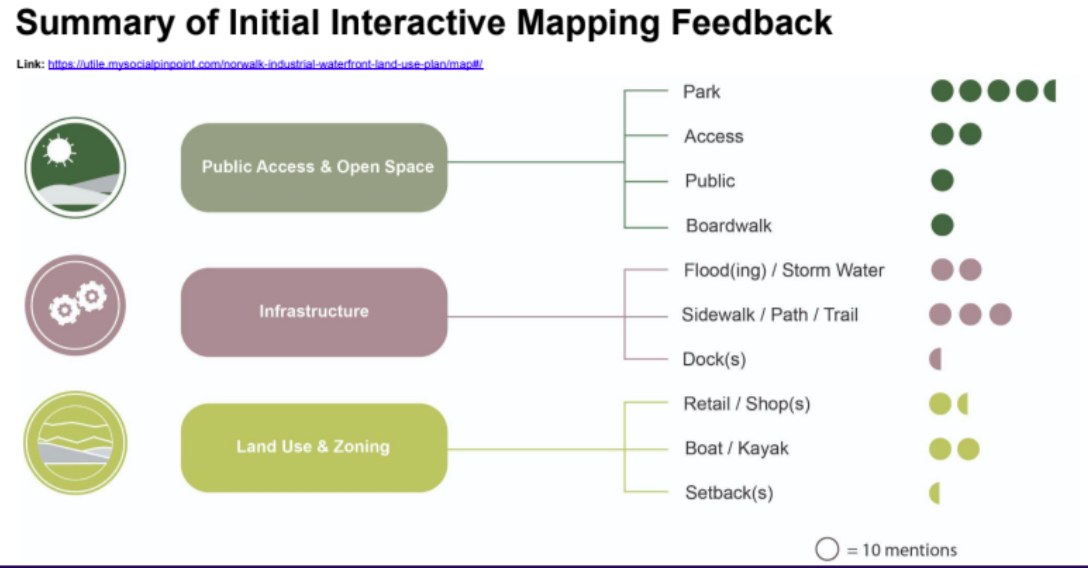 Below are some of the most popular comments for various areas along the Norwalk River.
Broader Marina District
The comments pinpointed to Veteran’s Park asked for improvements to the park and increased water access, the input being that the water frontage is substantially underutilized. Some ideas included putting in better boardwalk/paved paths around the park, adding plantings, picnic tables and access for kayaks and canoes. Along Water Street many respondents said they want to maintain the land for water-dependent uses, such as boatyards and aquaculture. Many liked the suggestion that anything vacant in this area should be required to be landscaped into parks accessible to the public since this area is flood-prone.East Bank of the Norwalk River
Input on the waterfront area on the River’s east side industrial-mixed use transition area included a desire by many to finish the Norwalk Harbor Loop Trail of which there is a missing section in this area. Commenters also wanted to see cleanup of the old asphalt plant in East Norwalk, possibly turning the area into a park that could serve as a buffer zone to accommodate flooding that occurs in the area regularly.Industrial/Commercial Business District Wall Street Area
Further up the river in the Wall Street area, many liked the idea of making the waterfront here more accessible to pedestrians, and increasing recreational marine uses such as canoe or kayak rentals. Other comments included zoning the area for accessory uses that would enable cafes and restaurants. Respondents also expressed a desire to connect the area under the bridge leading to Freese Park with the Harbor Trail Loop.Washington Street/Oyster Shell Park District
On the west side of the Norwalk River, a number of those surveyed would like to see the completion of pedestrian access from South Norwalk (SoNo) through Oyster Shell Park, making both pedestrian and bicycle access safer. Others expressed an interest in a continuous boardwalk in SoNo on the waterfront from Washington Street to Elizabeth or Hanford Streets, including in front of the Maritime Aquarium.Public Engagement for Industrial Waterfront Land Use Study
The Waterfront Land Use Study Steering Committee will continue to engage and inform the public with a series of public meetings. Overall themes that came out of this original survey will be discussed and participants will be asked to rank the top three issues/concerns/themes that they would like this plan to address. The committee will also make additional suggestions for land use and development intensity that the public can weigh in on.Give us your input in the latest survey
Examining the Use of Norwalk's Industrial Waterfront
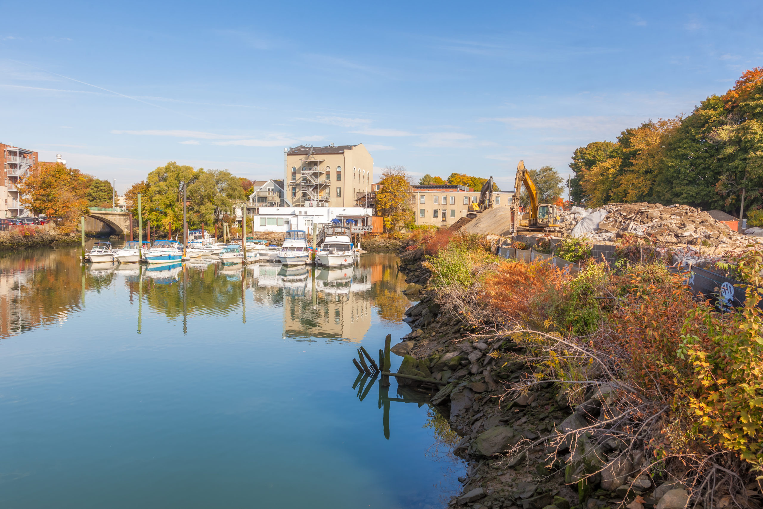 A beautiful city located on the Long Island Sound, Norwalk, CT has several photo worthy, waterfront destinations like the Maritime Aquarium or Calf Pasture Beach. These are great area attractions and unique spaces, but there are other waterfront areas, notably along the Norwalk River, that have historically been used for industry and other commercial purposes.
Norwalk is undergoing an assessment of the use of Norwalk’s industrial waterfront to determine what may be in store for the area. Read on to learn more.
Economic Development and Norwalk's Waterfront
City leaders across the nation view commercial waterfront districts as an opportunity for sustainable development. Norwalk is one city undergoing such an evaluation. The latest waterfront assessment is all about improving its waterfront properties to meet the needs of today. For example, Norwalk officials are reconsidering the use of the city’s industrial zones. At the same time, they’re examining how residents can best coexist with local industry. City planners hope to answer these same questions along waterfront property with the latest industrial waterfront land use study. The study is the result of a recommendation from the initial Industrial Zones study which suggests that waterfront industrial uses should be assessed separately from inland industrial uses as a result of their unique qualities. There’s an abundance of opportunities for Norwalk’s industrial property on the waterfront. The goal of the study is to ensure that the city meets the needs of residents and businesses. That’s why feedback from the public is being encouraged to influence how they move forward. The Industrial Waterfront Land Use Plan will be influenced by residents, business owners, and other local constituents.Examining Industrial Waterfront Uses
Part of the process of rethinking the Norwalk waterfront is to examine how the land zoned for industry is currently used. Already, there are several well-established businesses along the Norwalk River. They range from commercial marine facilities, to recreation and tourist areas, to industrial and commercial business districts. Many of these uses add to the maritime character of Norwalk and play a role in the regional and State economy.Environmental Considerations for Norwalk's Waterfront
In addition to creating more jobs and offering recreational and other options, officials also want to protect the area’s natural resources. The waterfront study will evaluate several environmental concerns, including:- Flood hazards
- Dredging for navigation channels
- Water quality


