February 4, 2022
 As the City of Norwalk studies how to optimize the industrial areas of its waterfront resources along the mid-to-upper Norwalk Harbor, the Planning and Zoning office is reaching out to the public and other stakeholders for their thoughts.
One of the ways planners have gathered input is via an online community mapping activity. This digital engagement, which started in late 2021, was the first of several opportunities to gather public comment. Participants added their input on how they would like to see the waterfront used via an interactive map where they placed comments pinpointing to specific areas in the study zone.
Keep reading to find out what the public would like to see along the industrial area of Norwalk’s waterfront.
Interactive Waterfront Survey Findings
In all, more than 150 comments were made by more than 55 stakeholders, with 1,100 people visiting the site.
A large majority of comments involved a desire to include public access and open space along Norwalk’s waterfront. Another popular comment was regarding infrastructure along waterfront areas such as the inclusion of sidewalks, paths and trails.
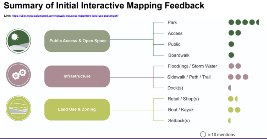
Below are some of the most popular comments for various areas along the Norwalk River.
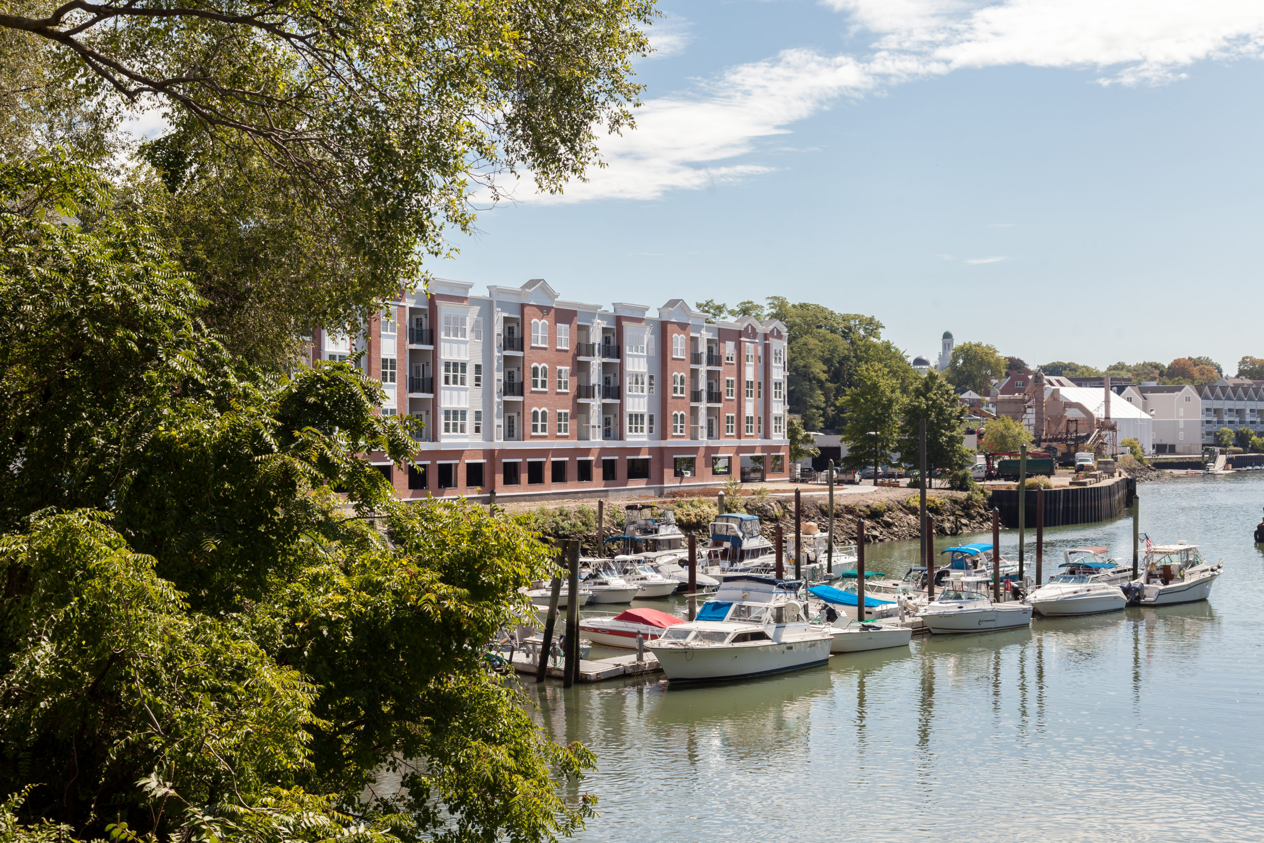
Broader Marina District
The comments pinpointed to Veteran’s Park asked for improvements to the park and increased water access, the input being that the water frontage is substantially underutilized.
Some ideas included putting in better boardwalk/paved paths around the park, adding plantings, picnic tables and access for kayaks and canoes.
Along Water Street many respondents said they want to maintain the land for water-dependent uses, such as boatyards and aquaculture.
Many liked the suggestion that anything vacant in this area should be required to be landscaped into parks accessible to the public since this area is flood-prone.
East Bank of the Norwalk River
Input on the waterfront area on the River’s east side industrial-mixed use transition area included a desire by many to finish the Norwalk Harbor Loop Trail of which there is a missing section in this area.
Commenters also wanted to see cleanup of the old asphalt plant in East Norwalk, possibly turning the area into a park that could serve as a buffer zone to accommodate flooding that occurs in the area regularly.
Industrial/Commercial Business District Wall Street Area
Further up the river in the Wall Street area, many liked the idea of making the waterfront here more accessible to pedestrians, and increasing recreational marine uses such as canoe or kayak rentals.
Other comments included zoning the area for accessory uses that would enable cafes and restaurants. Respondents also expressed a desire to connect the area under the bridge leading to Freese Park with the Harbor Trail Loop.
Washington Street/Oyster Shell Park District
On the west side of the Norwalk River, a number of those surveyed would like to see the completion of pedestrian access from South Norwalk (SoNo) through Oyster Shell Park, making both pedestrian and bicycle access safer.
Others expressed an interest in a continuous boardwalk in SoNo on the waterfront from Washington Street to Elizabeth or Hanford Streets, including in front of the Maritime Aquarium.
Public Engagement for Industrial Waterfront Land Use Study
The Waterfront Land Use Study Steering Committee will continue to engage and inform the public with a series of public meetings.
Overall themes that came out of this original survey will be discussed and participants will be asked to rank the top three issues/concerns/themes that they would like this plan to address.
The committee will also make additional suggestions for land use and development intensity that the public can weigh in on.